Stroud rural sustainable drainage project: taking SuDS beyond the red line.
By Chris Uttley, Stroud District Council.
Whilst the policy and regulation surrounding SuDS is the subject of current controversy, the principles of sustainable drainage and the role that SuDS can play in reducing flood risk is not. The basic principles of slowing, attenuating and infiltrating are applicable in a wide range of scenarios familiar to anyone involved in designing drainage systems for new developments or retrofitting systems onto existing developments.
We are able to work within a set of parameters that provide confidence that we can influence the hydrology sufficiently to determine positive or negative outcomes for our upstream and downstream neighbours.
So why is it that as soon as we step beyond the red line, we start to lose confidence in our ability to act and lose faith in the basic hydrological principles that SuDS relies on? Many are sceptical that we can achieve a real and demonstrable difference at a catchment scale, but that is exactly what we in Stroud are attempting to do.
The Stroud Rural Sustainable Drainage (RSuDS) project is funded by the Severn and Wye Regional Flood and Coastal Committee to put these same principles into practice throughout the catchment of the River Frome. Our task is to implement Natural Flood Management (NFM) or RSuDS (take your pick) to reduce flood risk in the catchment (265km2), improve water quality and enhance biodiversity.
We aim to reduce the maximum height of the flood peak or delay the arrival of the flood peak downstream. To achieve this, we are trying to restrict the progress of water through the whole catchment, by increasing the hydraulic roughness of the catchment as a whole. Our measures however, rely upon principles that are the same as SuDS within the red line:
1. we attenuate and store to restrict the rate of discharge from an area of the catchment.
2. we physically slow, by increasing roughness using structures or vegetation and finally,
3. we encourage or increase infiltration rates, wherever we can.
Most measures are in fact making use of a combination of these mechanisms Our aim is to locate interventions to provide benefits to downstream areas so work sites are located on flow pathways to maximise attenuation and/or infiltration. This is not always possible however. Equally important however, is the creation of project “momentum”, so we will work on sub-optimal areas with an enthusiastic landowner to add to project portfolio.
Whist it can seem daunting to undertake measures that impact on the whole catchment, our aim is to reduce flood risk and improve water quality through the cumulative benefits of a large number of small interventions. We don’t try to solve the whole problem with one or two projects, but we aim to achieve an impact by working as a community with many landowners over a large land area. Its this aspect that may require an attitudinal shift from flood risk managers. We are not able to or trying to solve all our issues on one or two work sites.
So what are we actually building? First and foremost, we are building relationships, with landowners, partners and communities. On the back of those relationships in the two years we have been working, we’ve built about 140 “large” structures, including about 110 large woody debris leaky dams, 12 field bunds, 9 culverts and soakaways and a variety of smaller interventions to deflect and slow the flow.
As a local authority, we are working primarily on Ordinary Watercourses. Not only does that make sense administratively (since the handover of responsibility for these areas to lead local flood authorities), it also makes sense environmentally because small streams and ditches are also the water courses where many of the problems affecting watercourses and increasing flood risk originate. Siltation, excess nutrients and flashy drainage are acute impacts with multiple pathways into a catchment, so we try to tackle them wherever we see them. Large woody debris leaky dams form a main part of our works because we have a good coverage of existing woodland. They also provide multiple benefits, including the natural re-engineering of stream morphology and function. We are also discovering the slight differences in construction that can be used to achieve different results. We can tune our design to deal with incision, cause deflection onto flood plain, create scour, reduce scour, attenuate large volumes, speed water up, slow water down.
We believe that our collective understanding has reached a stage where we can start to provide good standardised guidance on different techniques for Rural SuDS. We know what makes a good and effective structure and how to maximise benefits for flood risk, for water quality and biodiversity. We also have a good understanding of how to reduce any risk arising from our work, by careful choice of interventions suitable for a particular location. In short, we have a good understanding of what makes a successful NFM approach and how to keep costs low. What we cannot yet do is calculate exact volumes, provide assurances to 1:100yr standard or model the benefits. Those are future challenges.
Rather than trying to capture our experience in reports, we have produced a couple of films to share our learning. The first film, Rural Sustainable Drainage, natural flood management in the Stroud Valleys, examines the role of community and partners, the second focuses on practical methods and principles. The second film, recently finished, takes a more detailed look at principles and methods for natural flood management in small streams and their catchments. We try to show the variety of uses and designs for woody debris and how to put the principles into practice.
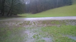
It is time to take SuDS beyond the red line and into the wider catchment to bring the same level of support and understanding to make Rural SuDS an accepted part of the mix of measures available to flood risk managers in every catchment. Our aim is to de-mystify natural flood management, provide plenty of photos and examples of structures and keep costs within real world budgets. The photos below show some of our structures in both low and high flow conditions.
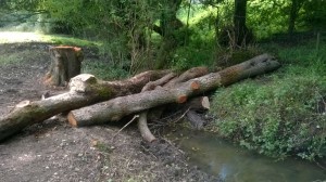
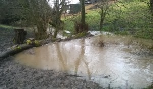
Structure on Stroud Slad Farm, Slad Valley (low and peak flow):
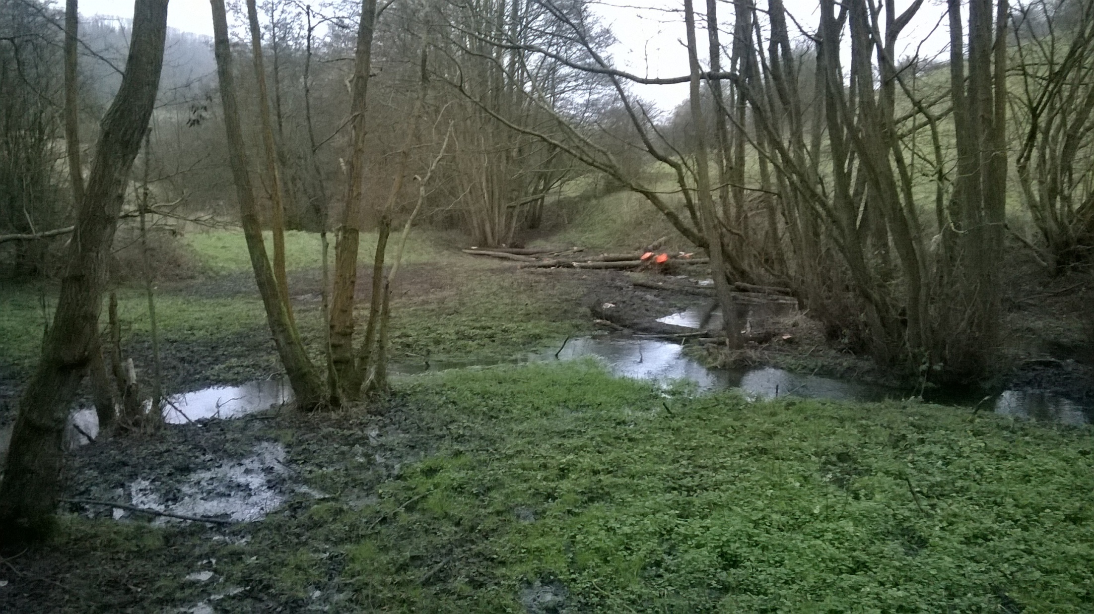
Structures on Snow’s Farm, Slad Valley (low and peak flow)

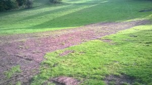
Field bund to attenuate surface flow on the Ebworth Estate, Painswick Valley (low and peak flow):
For more information on the Stroud Rural Sustainable Drainage project and to view the films and see more photographs, please visit:
www.stroud.gov.uk/rsuds