


Melton, School SuDS scheme, Mowbray
Where
Location
Burton Road, south of Melton Mowbray town centre, Leicestershire.
Description
The Post-16 Centre is a new school catering for Post-16 Students from the Melton Mowbray area. It sits on the site of the demolished Sarsen School, on the King Edward VII school campus. The building is served by car parking for both staff and students, with a number of smaller ancillary buildings for storage and plant. The site lies at roughly 106mAOD on a plateau surrounded by playing fields. The whole site is around 2.9ha. Surface water drainage flows to a Severn Trent Water open channel to the north.
|
|
|
Figure 1 Master plan (David Singleton) Click on image to enlarge |

 |
|
Figure 2 Landscape design (David Singleton) Click on image to enlarge |
Main SuDS used
The concept of a SuDS ‘treatment train’ has been employed. The building location was adjusted to enable an almost totally ‘above ground’ solution. Some limited underground drainage was used, such as to connect under heavily trafficked areas. It was felt that, being a college site, with a great many students close to the building envelope, that rainwater downpipes had to be taken underground initially rather than discharging directly into swales. The Environment Agency requested the imposition of a condition requiring a landscape management plan (LMP) for the site.
 |
|
Figure 3 Schematic of water sensitive urban design for Melton Post-16 Centre. Click on image to enlarge |
|
|
|
Figure 4 Swales at the eastern side of the site with grass establishing in January 2011 (David Singleton) |

How it works
A swale system carries water from hard surfaces via ‘nested wetlands’ to a main dry detention basin. Bio-swales are very shallow and have carefully graded side slopes to enable mowing. As far as possible, the swales include a narrow filter strip which will provide some pre-treatment. Longitudinal sections were adjusted in fine detail on site to enable wetter areas to ‘pond’ water and allow intermediate development of taller marginal species. The swales discharge to a detention basin, thus providing two treatment-train or treatment stage components.
 |
 |
|
Figure 5 The building location was adjusted to enable an almost totally 'above ground' solution |
Figure 6 The swale system carries water through a 'nested wetland' to a main dry detention basin |
Runoff from other hard surfaces is collected by more traditional techniques, such as gullies and linear drains. This system includes a secondary an additional dry detention basin. This contains a sediment forebay with upper and lower levels separated by gabion baskets and earth forms, which will encourage settlement. Water is then directed to the main basin. Runoff from roof areas is directed to a rainwater harvesting tank, prior to discharging to the main basin.
 |
|
Figure 7 The swales are shallow and have carefully graded slopes to enable mowing |
Specific details
The soils on site are predominantly clay. These have been heavily re-worked as part of the development. Soil-water infiltration is made possible by shallow gradient, unlined swales and detention basins, though the amount is expected to be low. The scheme was designed to not flood for a 1 in 100 year return period rainfall event, plus an allowance for climate change. Water exits the site via a gabion headwall in the dry detention basin, which in turn directs water to a Severn Trent Water open channel in the north. The discharge rate is controlled by means of an orifice plate. Planting was modified to cope with wetter than anticipated conditions.
|
|
|
|
Figure 8 The main detention basin showing the elevated ‘sedge shelf’ close to the new pedestrian bridge in October 2010. (David Singleton) |
Figure 9 The main detention basin with the new pedestrian bridge installed in January 2011. This allows people contact with the water system, and an elevated view of the basin and sedge shelf (David Singleton). |


Benefits & achievements
-
Control of runoff to pre-development (Brownfield) rate.
-
Wetland features manage runoff to ensure clean water enters the natural drainage system.
-
No oil interceptors. Instead water is treated through SuDS components.
-
Significant reduction of cost of installation over a conventional piped or underground drainage system (of the order of £100,000).
-
Massive biodiversity potential.
-
Powerful and exciting visual features making ‘sustainable’ design obvious. Engagement has been achieved with school staff and students.

Figure 10 The curvilinear form to the swale system, combined with ground modelling and planting, creates a series of outdoor spaces to be used for teaching. (David Singleton)
-
Additional security and protection of building from access for theft and illicit car use of grassed areas. The ‘moat’ effect.
-
Opportunities, via the Landscape Management Plan, for a high degree of curriculum integration at ‘A’ Level.
-
Ongoing work – potential data on performance. Experience elsewhere suggests school can provide this as part of learning and teaching.
-
Monitoring of performance through LMP. Anticipated. Benefit: Workshops with staff to explain designs at concept stage and allow staff to contribute to design by indicating how they would use the features and what curriculum requirements might be.
Challenges & lessons learned
-
Uncertainty for schools and local authority overcome.
-
Safety and maintenance concerns overcome.
-
Reassurance provided by carrying out visits to established schools SuDS projects (at Bushloe School, qv) and seeing these work well. Speaking to staff at these schools.
-
Some initial misunderstanding that the SuDS treated foul drainage.
Update: May 2016
The swales are now well established, with their development being monitored by DSA. The swales offer a great means for practical learning and re used in Geography and Biology lessons to aid teaching.
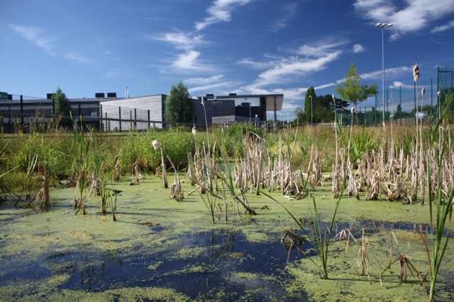
Figure 11: The Swales fully integrated into the landscape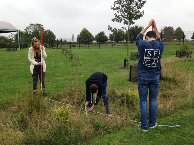
Figure 12: The Swales providing a great environment for the students to study
Interaction with local authority/team
Support from Leicestershire County Council Planning and Environment Agency.
LCC planning had experienced success of a number of SuDS schemes in schools.
Environment Agency consultation via LCC requested a SuDS solution with an LMP. This was passed on to the team and conditioned.
Team
Client: Leicestershire County Council. John Humphries.
Landscape Architect: DSA Environment + Design, Nottingham. David Singleton
Engineer: ARUP, Nottingham. Mike Wood, Matthew Johnson.
Architect: A+G, Loughborough. Will Aust, James Hutton.
Contractor: Willmott Dixon, Nottingham. Stephen Waldron, Gustave Kedzior.