Where
Location
Warren Hills Road, 2km north east of Coalville town centre and accessible from M1 junction 22 or 23. The site is on private land. For access speak to the school directly. http://www.forestway.leics.sch.uk. The site is in the National Forest.
Description
Forest Way is a new Special Educational Needs School, opened in January 2009. The site has one main building with new hard and soft surfaced play areas, multi-use games area and car parking. It is set on a campus of four schools on the edge of Coalville on the site of a demolished high school.
It lies at roughly 200mAOD on the edge of the elevated ground of Charnwood Forest. The site falls steeply from north to south. Following construction of the school, various improvements to the grounds were made, including new horticultural teaching areas, paths and surfacing.
The overall development site is approximately 2 hectares including the school buildings, hard surfaced play areas, surrounding earthworks and soft play areas. The surface water for the development connects into private drainage on the school site which then conveys the water into an existing ditch.
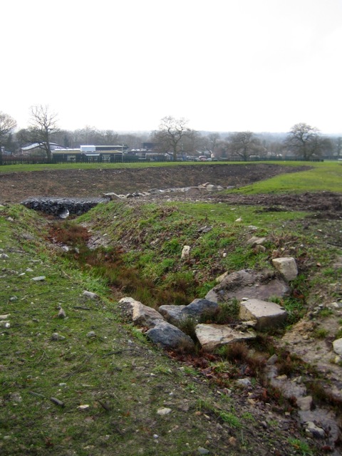 |
| Figure 1: SuDS basin under construction |
Main SuDS used
From the very early stages of the project, the brief demanded an imaginative approach to using surface water creatively, to encourage maximum biodiversity and for teaching. A ground investigation undertaken early in the design process showed that the underlying clayey ground was not sufficiently permeable for infiltration drainage (e.g. soakaways) to be used. However, the layout of the development site provided the opportunity to utilise open areas to the east and south of the school building for above ground drainage systems. The concept of a SuDS ‘treatment train’ or ‘SuDS management train’ to deal with stormwater was developed between DSA, Arup and the main contractor, Willmott Dixon.
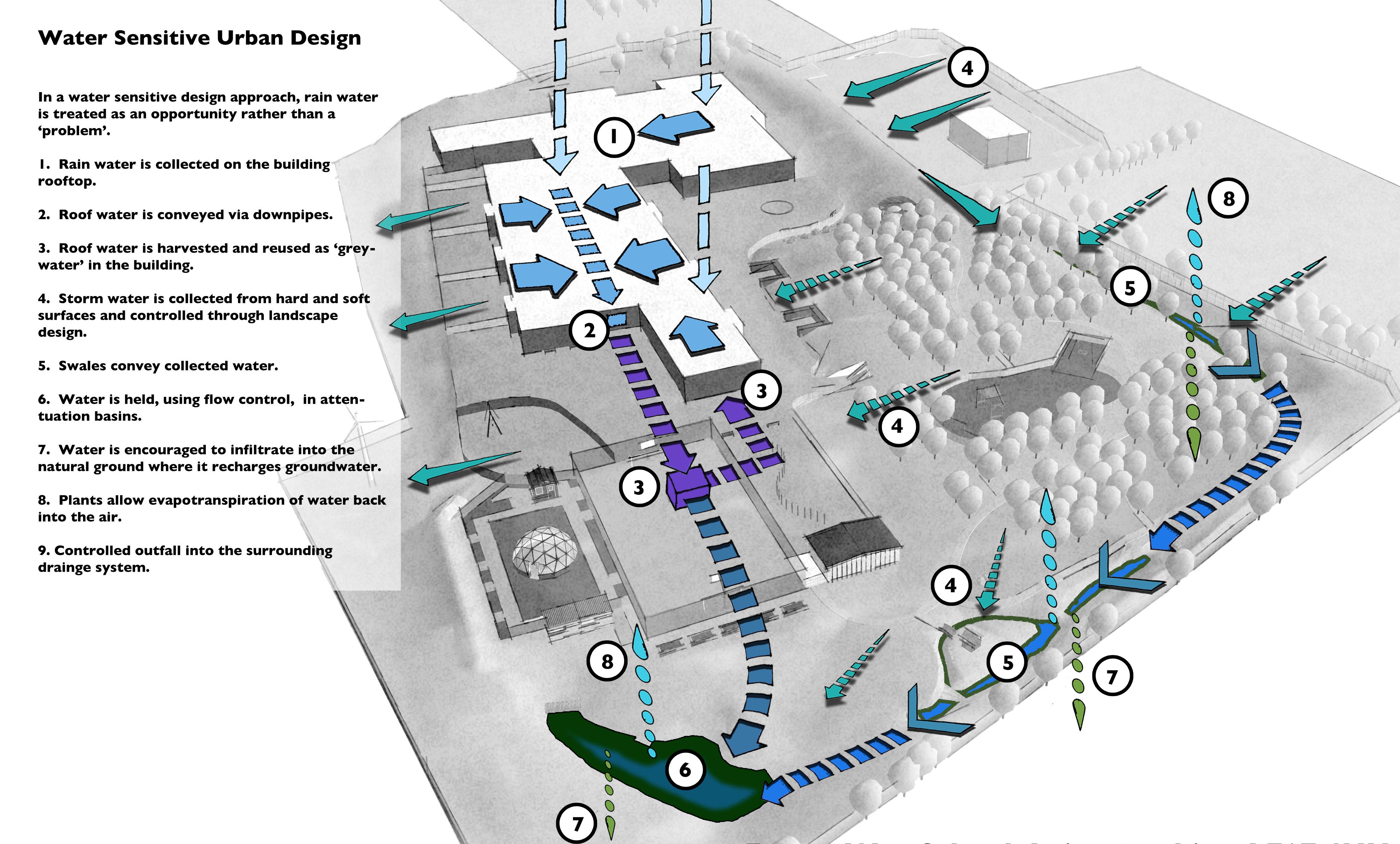 |
| Figure 2: Schematic of water sensitive urban design for Forest Way School |
Very little underground drainage is used. Due to the sloping ground level and the lack of free space close the buildings, rainwater from impervious surfaces are generally collected using either proprietary kerb drains or filter drains which discharge into a swale. Runoff from roofs is connected into a separate piped system that feeds a rainwater harvesting tank, as non-potable water supply for the building.
A long swale conveys water from the northern car park to a detention basin in the southeast, which serves as the main site-scale attenuation feature. An orifice plate provides flow control before the system discharges into an existing drain. Flow is limited to existing runoff rates.
Drainage to the west of the school (roughly 10%) is taken conventionally via pipes to the drainage connection.
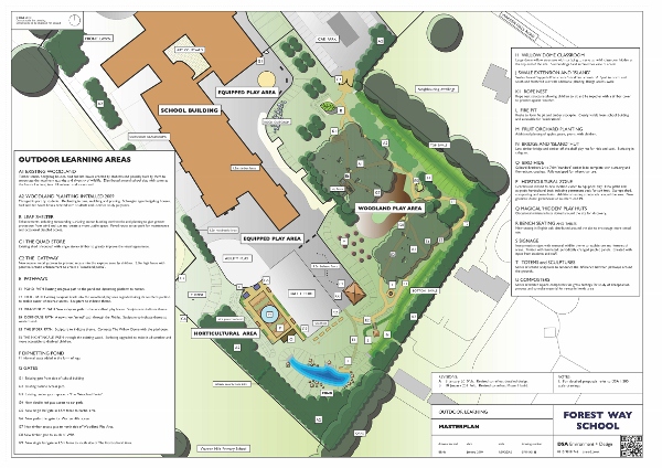 |
| Figure 3: Plan of outdoor learning areas (January 2010) - click image to enlarge |
How it works
Most runoff is taken from the building roof and paved areas above ground into either a swale or pipes and gullies, and is then conveyed around the east of the development to a large detention basin. The basin and swales contain an extensive area for ‘natural play’, within which are a series of designated play spaces for children of different ages. The basin is specifically designed to include permanent pools for curriculum use and has a ramp to allow disabled wheelchair access.
The total catchment area is approximately 2 hectares.
The swale is very shallow and was carefully designed and constructed to ‘fit’ into the new landscape. Longitudinal sections were adjusted in fine detail on site to promote formation of micro-pools and allow intermediate development of taller marginal species. Swales contain ‘baffle’ to keep velocities to a minimum.
Rocks, excavated from the site, were re-used to improve the ‘natural’ appeal of the system. Swales are approximately 159m in total with connecting linear drainage keeping surface water just below the surface level.
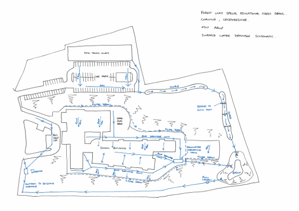 |
| Figure 4: The plans |
Specific details
Forest Way was formerly a high school. Surveys revealed that its overall biodiversity was low, relative to other sites in the area and no wetland was present.
Soils on site were heavily re-worked to create a level platform for the school building and play areas. The maximum depths of cut and fill were in the order of 4m. Ground conditions are generally cohesive.
The scheme was designed to safely manage a 1in 100 year plus 20% for climate change return period storm. The discharge rate from the basin into the existing drain is approximately 25 litres per second. The basin can store a volume of around 500m³ at a maximum depth of 1m for extreme storms . Headwalls to drains have been constructed using rock filled gabion baskets to improve aesthetic appearance. Planting is allowed to grow around these.
 |
 |
|
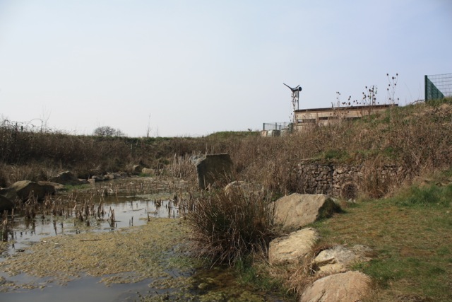
Figure 5: A bird hide has been constructed to allow views across the basin (March 2012) |
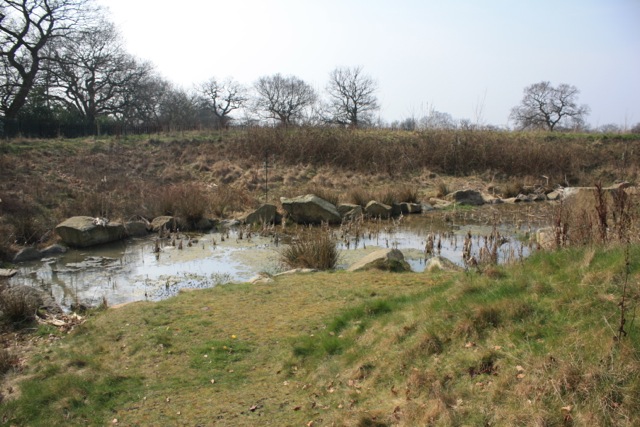
Figure 6: General basin view (March 2012) |
The design includes 600 mm freeboard and an emergency overflow in case of blockage or exceedance. If the basin water depth exceeds the maximum design level, excess water will flow into an adjacent ditch to ensure water is conveyed away from buildings and adjacent buildings.
The drainage system discharges into a 225 mm diameter private drain.
Planting was modified to cope with actual conditions on the ground. It was observed that ponding occurred, due to considerable variations in soil structure, in places along the system that could not be anticipated at design stage.
A Landscape Management Plan, that guides decisions on annual maintenance and allows costing, covers the site as a condition of planning. Forest Way continue to work closely with the landscape architects to maximise opportunities for teaching and learning and to increase the contact pupils have with the natural world.
A novel feature of the scheme has been the engagement of the local community in the project. The opportunity was presented to show children at two of the local schools what was happening and to work with them in the design of some of the art features, signage and play areas. This enabled the idea of SuDS as a learning and teaching resource to be explained.
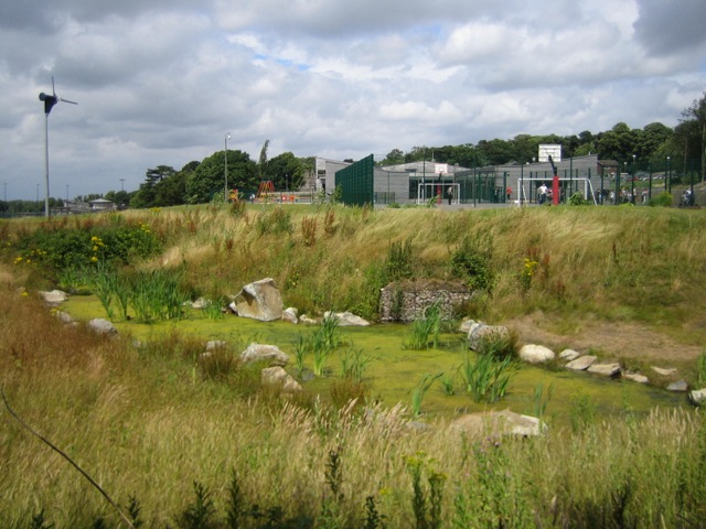 |
| Figure 7: Completed basin (July 2010) |
Benefits and achievements
-
Control of runoff to greenfield runoff rate.
-
Wetland features manage runoff to ensure clean water enters the natural drainage system.
-
Rainwater runoff from the main car park is treated biologically through the SuD system. One small oil separator was required for the mini-bus drop off area due to the site levels.
-
Savings in cost of installation over a conventional piped or underground drainage.
-
Massive biodiversity increase on a site that had no water or wetland before.
-
Powerful and exciting visual features making ‘sustainable’ design obvious.
-
Engagement with school staff and students.
-
Extended teaching and learning.
-
Ongoing work – potential data on performance.
-
Monitoring of performance through LMP.
-
Anticipated continued involvement of staff and students.
-
Formed case study allowing further development of ideas in other schools (See also MV16 Melton Mowbray case study).
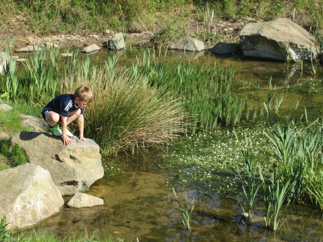 |
| Figure 8: The completed SuDS scheme brings learning benefits for the School children (Summer 2013) |
Challenges and lessons learned
-
Restricted site and levels determined a sub-optimal solution with a proportion of the drainage treated conventionally.
-
Safety and maintenance concerns overcome.
-
Reassurance provided by carrying out visits to previously installed SuDS schemes including Castle Rock and Bushloe and seeing these work well.
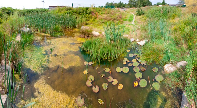 |
| Figure 9: Species and habitat diversity |
Interaction with Local Authority and Environment Agency
Support from Leicestershire County Planning.
Support from Environment Agency.
Officer contact: Planning Case Officer - Chris Noakes.
Team and details
Client: Leicestershire County Council Property Services. John Humphries, Nigel Dutton
Main Contractor: Willmott Dixon Construction, Nottingham. Les Henson, Steve Waldron.
Landscape Architect: DSA Environment + Design, Nottingham. David Singleton
Engineer: Arup Nottingham, Mike Wood.
Architect: Hunters, London. Andy Radcliffe.
Status: Constructed 2009
For more details contact: DSA: 0115 981 8745 www.dsa-ed.co.uk, Arup: 0115 948 4711


