


Bridget Joyce Square, London
Where
Bridget Joyce Square (Australia Road), White City, London, W12 7PH.
Description
The project, occupying part of Australia Road, is located between a school and two playgrounds in the heart of White City. The previous road and parking formed a hazard for children crossing the road and made school drop-off and pick-up difficult.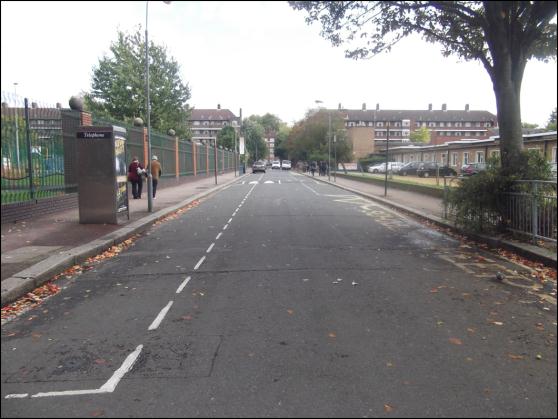
Figure 1: Site pre construction
It lies within the Counters Creek sewer catchment, which is well documented to be exceeding its capacity resulting in flooding of properties downstream. In addition, hydrological modelling of the Hammersmith & Fulham borough demonstrates that this stretch of Australia Road is susceptible to significant surface water flood risk.
The scheme creates an urban public park through the use of traffic restrictions, new surfacing, new elements of green infrastructure and street furniture that forms a valuable community resource whilst helping to reduce the area’s contribution to flooding. The park is designed to provide a dedicated setting for community events, such as festivals, fairs and markets, and to provide an attractive and safe social space for informal, daily community use with improved access to the school and playground.
The scheme also provides connectivity and a safer pedestrian passageway between Wormholt Park and Hammersmith Park.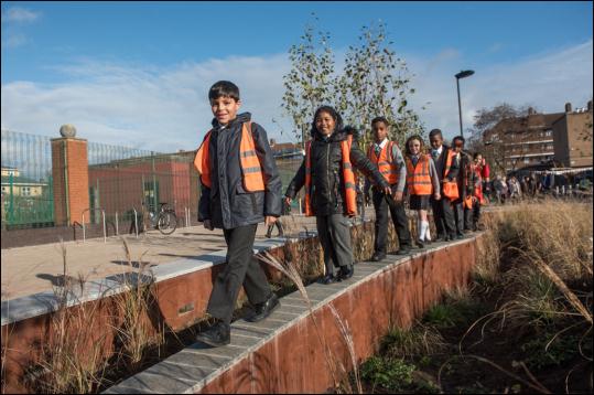
Figure 2: Connective and safe pedestrian environment post construction
Main SuDS components used
- Permeable paving
- Planted basins
- Rain gardens
- Tree planting
- Downpipe disconnection
Extent
- Total Site Area - 2,700m2
- Length of carriageway – 121m
- Permeable paving - 1,320m2
- Planted basins – 335m2
- Rain gardens – 120m2
- Number of trees - 49
Objectives
- Transform the road into a shared space for pedestrians and cyclists to create an “urban oasis” that makes a bold visual statement and instils a sense of pride within the local community
- Provide a multifunctional space to be used for a variety of events
- Provide significant educational potential whist being safe for the numerous children who use the site on a daily basis
- Create a space where landscape serves a vital drainage function providing flood resilience against known surface water and sewer flooding issues in the area and provides local climate change adaptation benefits.

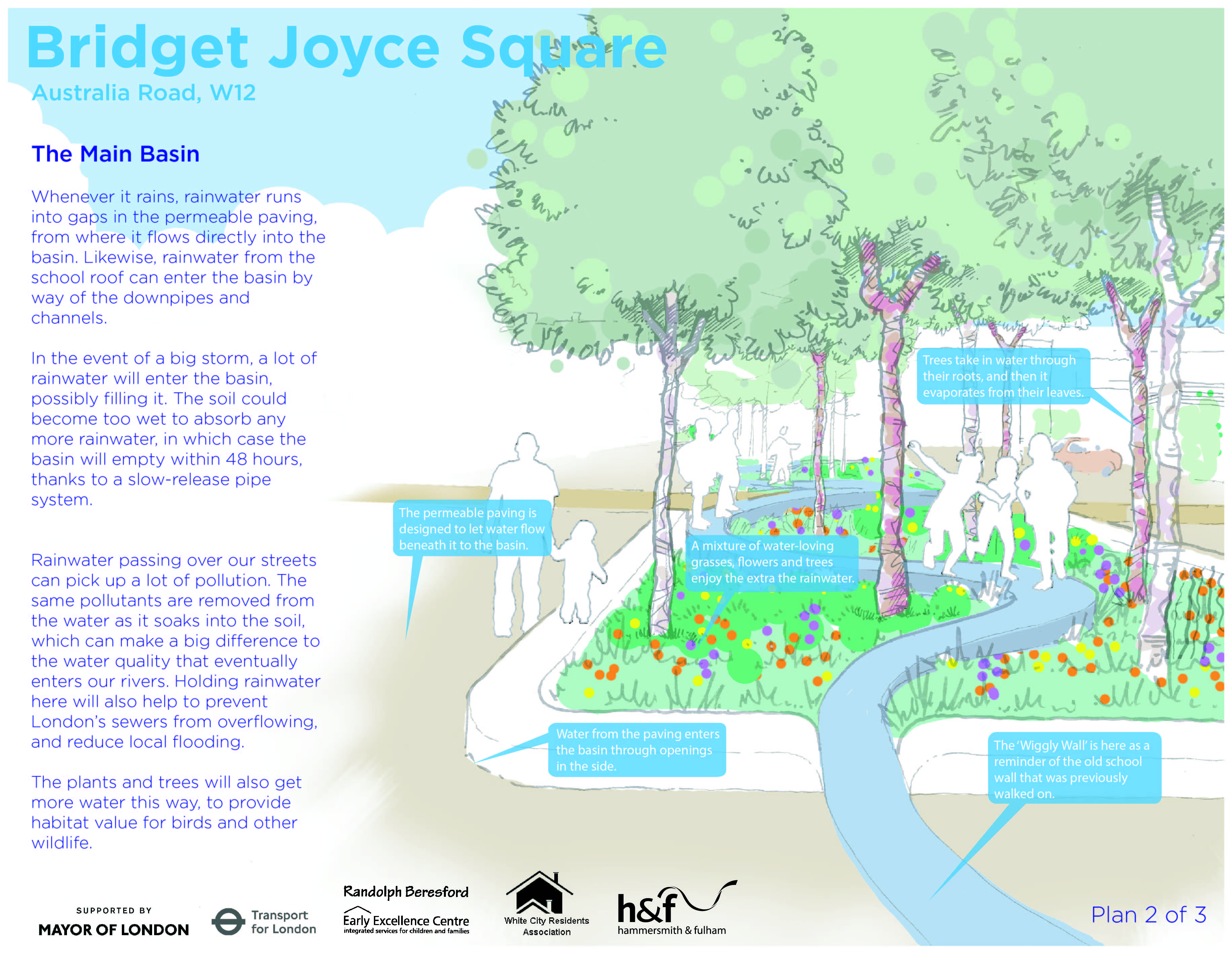
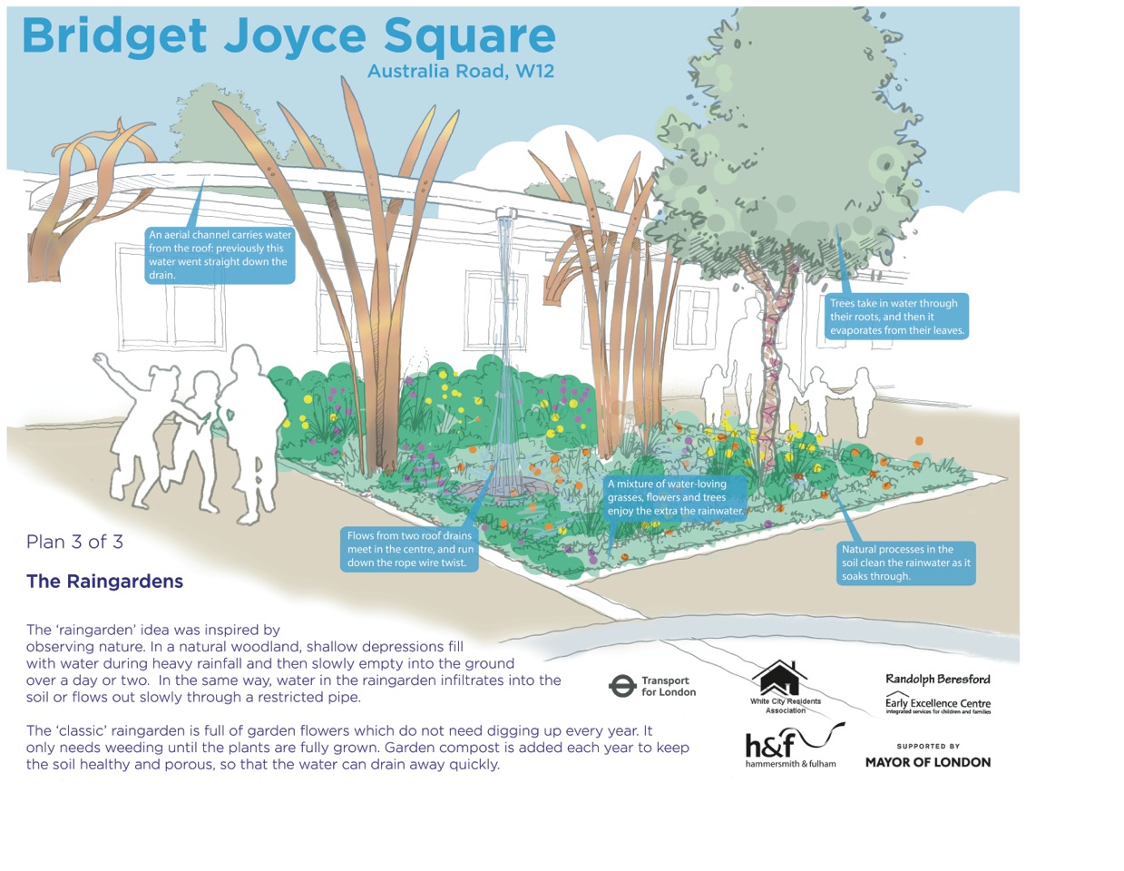
Figures 3 - 5: Concept and interpretation
How it works
- Landscape design aspects such as the sculptural downpipes and wiggly walls that weave through the basins provide the scheme with its unique character and allow for significantly increased interaction between the users of the site and SuDS.
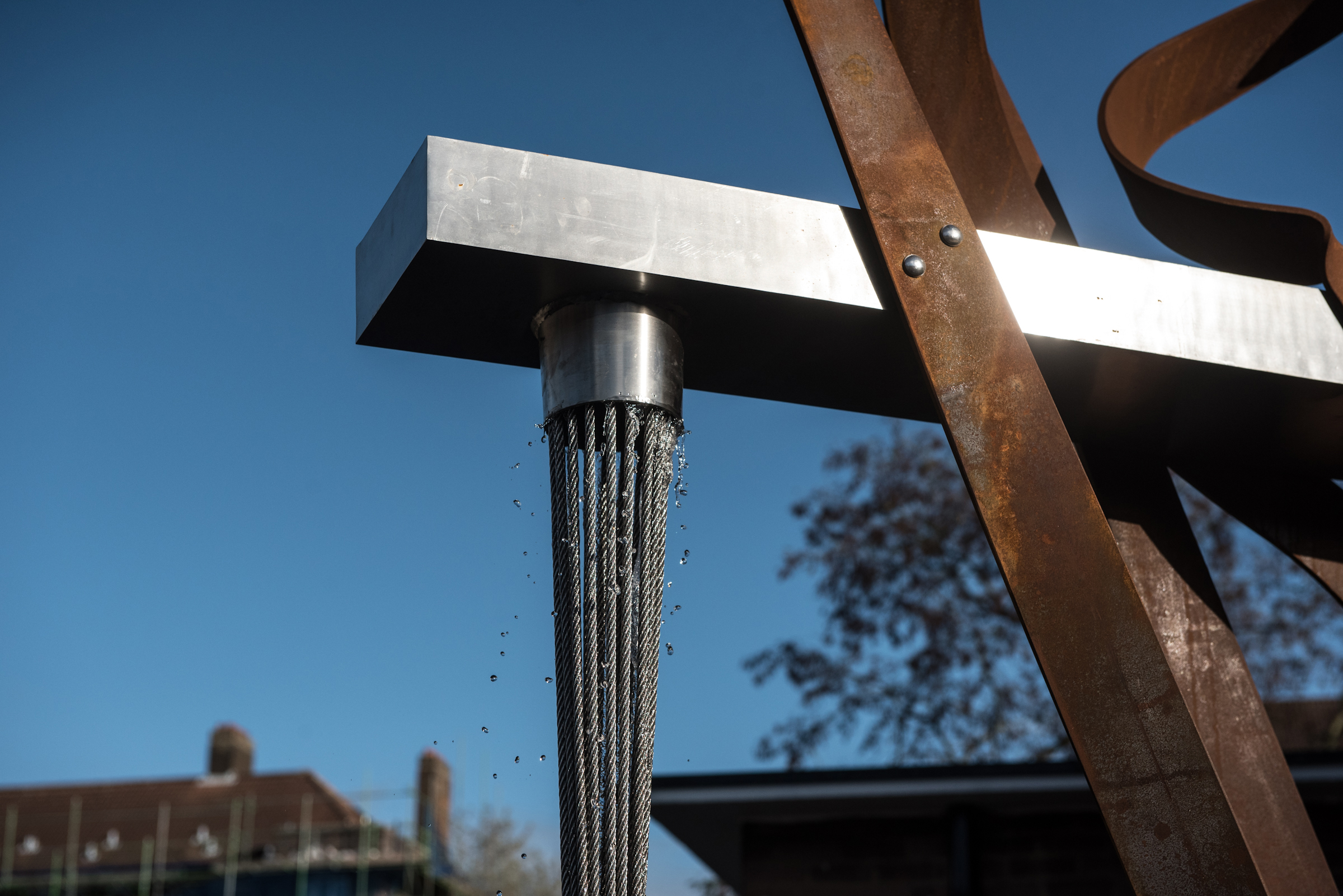
Figure 6: Sculptural downpipes
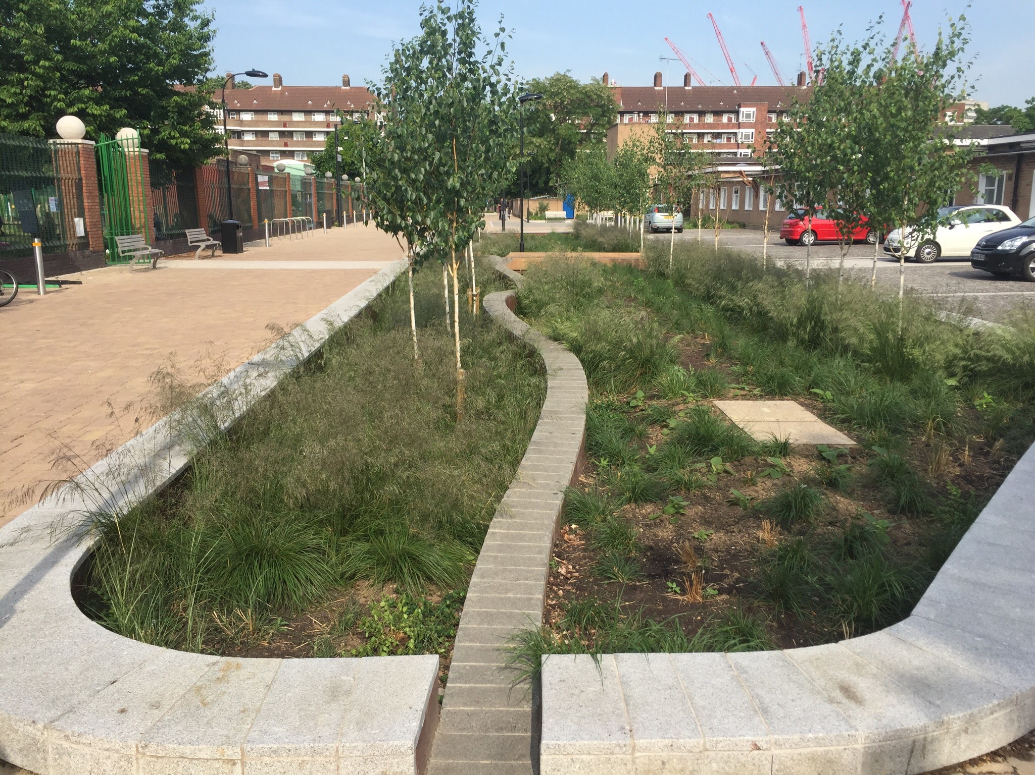
Figure 7: Planted basin, incorperating 'wiggly wall'
- Permeable block paving (1,320m2) has been designed to work with existing site levels and negate the requirement to excavate the existing concrete road slab. The depth of permeable aspect of the pavement (blocks, grit and 50mm geocomposite) overlies the existing concrete slab to a depth of 180mm. This conveys up to a 1 in 30 year storm event and caters for heavy loads. The existing concrete slab provides additional structural support.
- The permeable paving and disconnected downpipes from the surrounding school and playground buildings direct rainwater to the heavily planted basins and rain gardens, providing over 55m3 of storage capacity. This does not include allowance for the interception losses that will occur within the permeable pavement and the basins. The integration of trees within the main basin will further enhance these losses.
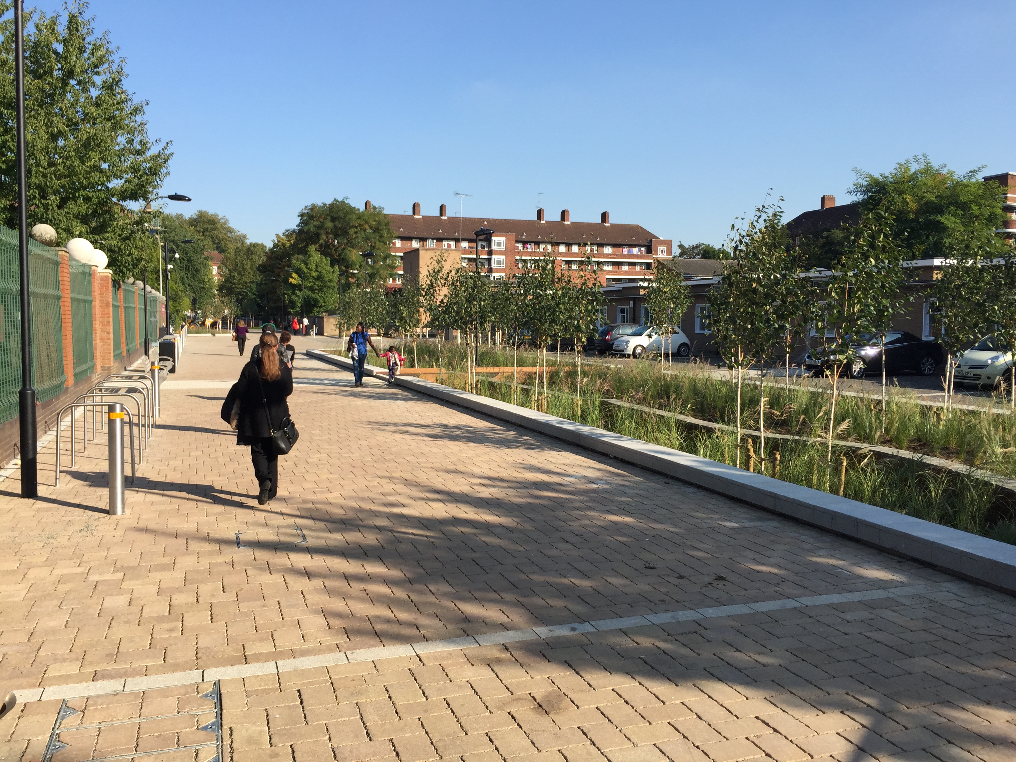
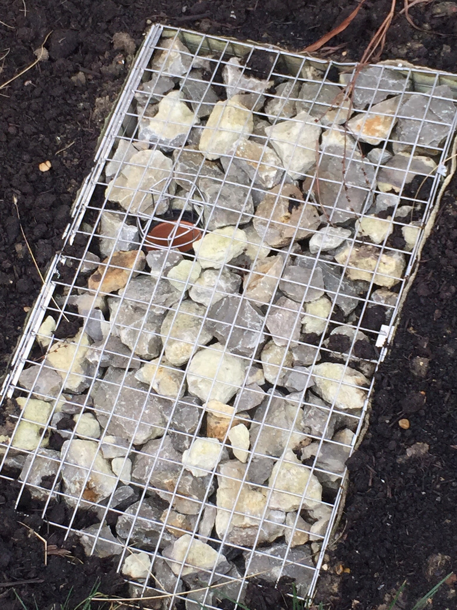
Figure 8: Permeable paving directs water to heavily planted basins
- Flow controls have been designed to restrict flows to below 1 l/s (which is significantly less than the 5 l/s generally adopted by industry) and retains more flow onsite for an extended period. This improves treatment performance, increases opportunity for losses to occur and increases protection to the sewer. This is achieved through intelligent design of the drainage outlets minimise the risk of blockage, yet ensuring easy and safe access for a single member of council staff to inspect and maintain.
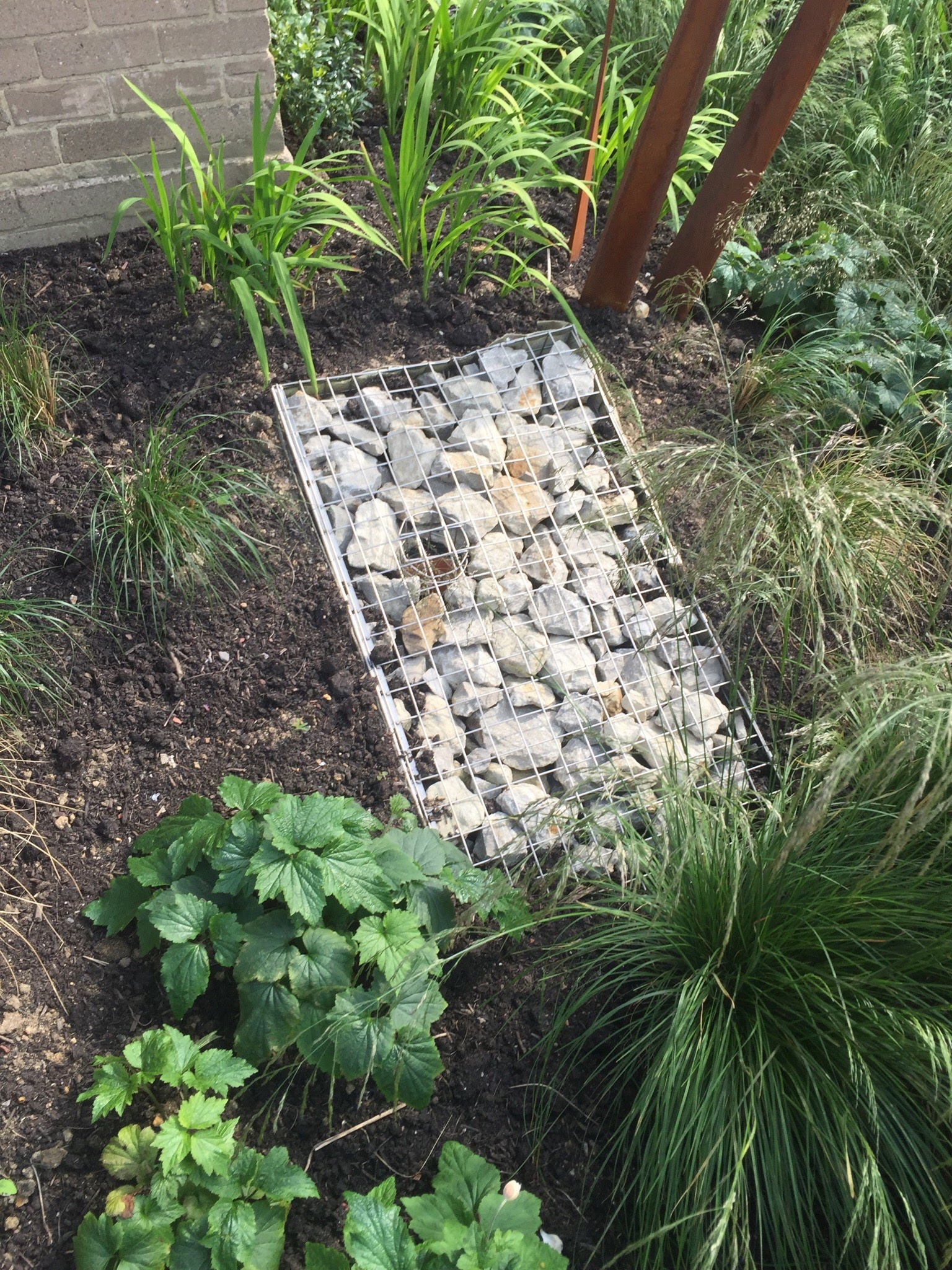
Figures 9 and 10: Drainage outlet
- The scheme uses sculpture to replace traditional downpipes in order to make water flow visible and to celebrate rainfall. The sculpture also provides an important security deterrent against those trying to access the flat roof to the front of the school. Downpipe disconnection has also been achieved from the local community centre which is located adjacent to the smaller basin.
- Educational boards have been installed to explain the design and monitoring equipment will provide robust evidence on the performance of the scheme.
Benefits
- Carriageways adaptations have made the area and its community assets safer.
- Reduction in local and wider flood risk.
- Annual flow volumes into the combined sewer overflow have been reduced by 50%.
- Flows have been retained as close to Greenfield rates as possible for the 1 in 1 year and 1 in 10 year (where CSO spill and urbanised flooding may be more prevalent).
- The design of the flow control and utilisation of storage ensures that the majority of runoff volume is detained on site until downstream risks have passed (CSO spills and sewerage / surface water flooding).
- The attenuation of water and associated vegetation has made a contribution to the amelioration of air pollution (principally NOx and PM) and water pollutants (hydrocarbons and total suspended solids). The majority of the trafficked areas are permeable paved. This takes out heavy metals and hydrocarbons prior to discharge the vegetated basins. This approach was not possible across the entire site and the school car park contributes runoff directly to the basin. The school were not in favour of using permeable paving on their site at the time.
- The ecological considerations (hydrological and vegetative) have provided conditions for biodiversity to increase as the scheme matures.
- The scheme provides an important educational resource which will be enhanced through the use of monitoring results.
- Anecdotal evidence would suggest that there is strong community buy in. There is a lack of vandalism when compared with similar sites in the Borough.
- The school have taken on responsibility for maintenance of the rain gardens and car park surfacing by their onsite caretaker, and Hammersmith and Fulham highways department have taken on maintenance of all other aspects including basins and all chambers.
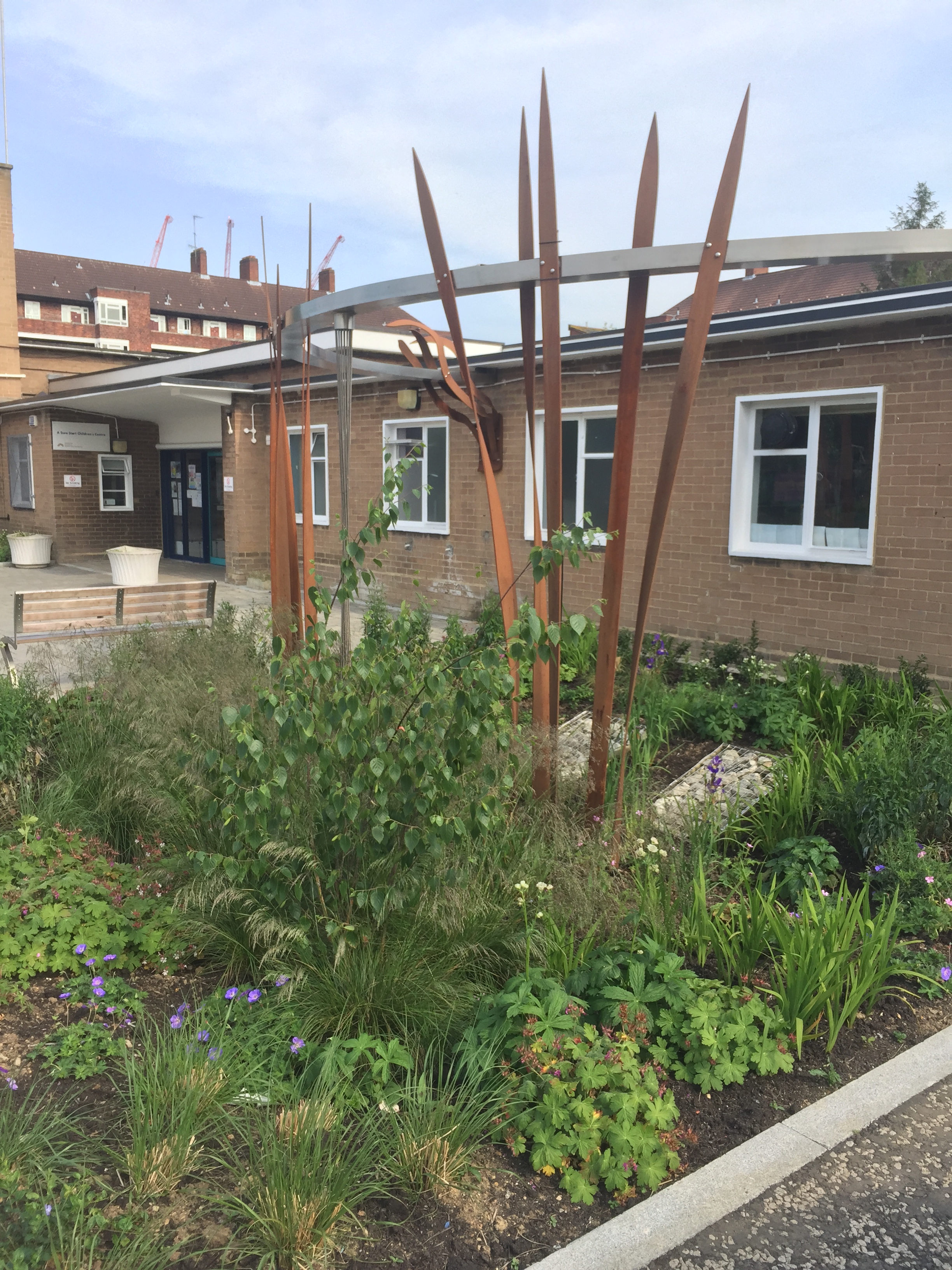
Figure 11: Rain gardens with sculptural downpipes
Lessons learned
- Supervision of SuDS construction by experienced designers is essential.
- Involvement of the construction contractors early in the design process ensures best material choices and construction methodologies.
- Community engagement is essential to the successful embracement and understanding the benefits of the scheme.
- Urban regeneration can provide multi-functional benefits including drainage function.
- Landscape design which makes a bold visual statement can elevate the scheme and instils a sense of pride within the local community - the importance of the end user should not be under-estimated.
Cost:£900,000
Date of completion
Project inception: Summer 2013
Construction: March - October 2015 (32 weeks)
Project opening: November 2015
Project partners
London Borough of Hammersmith & Fulham
Transport for London (Funder)
Greater London Authority (Funder)
Robert Bray Associates (Landscape architect / SuDS designer)
McCloy Consulting (Engineer / SuDS Designer)
F M Conway (Contractor)