- Delivering SuDS
- Using SuDS
- Background
- SuDS principles
- Benefits of SuDS
- Benefits of SuDS
- Why developers should choose SuDS
- Flood risk management
- Water quality management
- Biodiversity & ecology
- Amenity
- Air quality
- Building temperature
- Carbon reduction and sequestration
- Crime
- Economic growth
- Enabling development
- Flexible infrastructure/climate change adaptation
- Education
- Groundwater recharge
- Health and well being
- Pumping wastewater
- Rainwater harvesting
- Recreation
- Tourism
- Traffic calming
- Treating wastewater
- SuDS components
- SuDS components overview
- Source control
- Swales & conveyance channels
- Filtration
- Infiltration
- Retention & detention
- Wetlands
- Inlets, outlets and control structures
- SuDS performance & monitoring
- Delivery
- The costs & benefits of SuDS
- Adoption & maintenance of SuDS
- Legislation & regulation
- Design guidance
- Retrofitting SuDS
- Drainage exceedance
- Home
- Delivering SuDS
- Drainage exceedance
- Managing exceedance
- Pathways & conveyance
Pathways & conveyance
Identifying above ground flood pathways
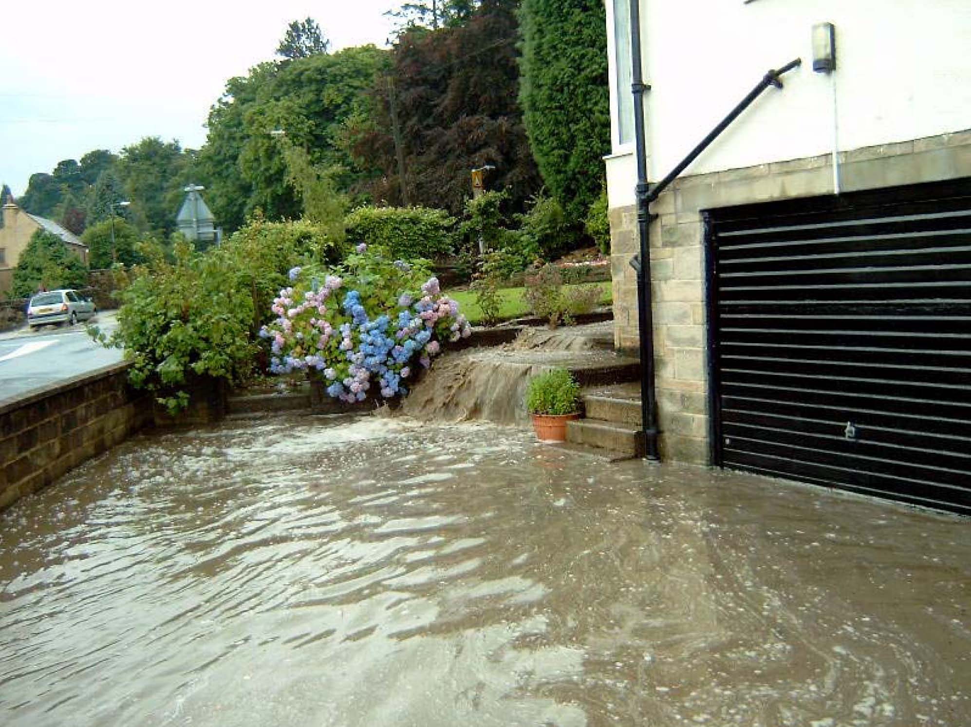
Exceedance conditions resulting in above ground flood flow occur either when the capacity of the drainage system is exceeded and/or where the rate of runoff exceeds the inlet capacity of the drain. When calculating runoff for extreme events it should be remembered that considerable runoff can occur from undeveloped plots (Figure 1), and these should be accounted for. Without good design, flood flow will follow default flood pathways and this can lead to indiscriminate flooding of property. It is possible to avoid this by identifying and designing above ground flood routes.
|
|
|
Figure 1 Exceedance flow generated by runoff from fields to the rear of the property |
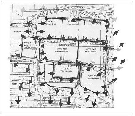
In extreme events flood routes form on existing roads, pathways and in dense urban areas through passages between buildings. These pathways may be determined by site inspection, and where necessary confirmed by digital terrain models. Where data on dimensions and levels of such potential pathways exist, they may be represented in any drainage simulation models (see figure 2).
|
|
|
Figure 2 Above ground flood pathways identified during a site development study. Different shaded arrows refer to different types of above ground pathway |
The capacity of surface pathways
If property flooding is to be avoided, then the conveyance capacity of flood pathways should be designed so as to convey the whole of the exceedance flow (design pathways). The conveyance capacity can be influenced by relatively minor detail such as kerb heights. Often the effective conveyance or routing of flood flows can be achieved by modifying the detail of a carriageway cross-section, for example by revising the detail of drop kerbs, or lowering the highway surface.
Surface pathways should be linked together in the same way as conventional drainage networks to effectively convey the exceedance flows off the developed site. Flows should be prevented from accumulating at low spots except where temporary surface storage is incorporated into the design strategy (see figure 3).
|
|
|
Figure 3 Unplanned ponding of surface flood flow at a low spot leading to property flooding |
When designing surface flood pathways the designer should remember that unlike conventional drainage they will only convey significant flow very rarely. In practice they will be used regularly for other purposes, and it’s this primary function that also needs to be considered. For example, a grass lined channel may be used to convey exceedance flow across an area of open space. The channel will normally be used for recreational purposes and the designer needs to consider the implications of this. For example:
- what safeguards will be in place for its continued availability as a flood channel? Its use for this might be compromised if a fence were to be constructed across its path.
- when the channel is in use for flood conveyance, the public may suddenly be exposed to unexpected flow depths and velocities. What criteria will be used to limit depth and velocity in order to protect public safety? What education and flood warnings will be used to inform the public of design considerations.
- after the event, what measures will be in place to clear out any sediment, litter or polluting material? How will the public be warned about the potential hazards of a flood pathway in their community?
Read more on:


